|
Interaction type |
Public → Government → Public |
|
Trigger Event |
A greater vision to create a “Smart City” |
|
Domain |
Topographic Mapping |
|
Organisation |
Ulaanbaatar City Governor’s Office (UCGO) |
|
Actors |
1. ICT World Bank2. Humanitarian OpenStreetMap Team (HOT)3. Mongolian University of Science and Technology (MUST)
4. City officials (UB City – IT department) 5. Mongolian Land Management, Geodesy, and Cartography Department |
|
Data sets in use |
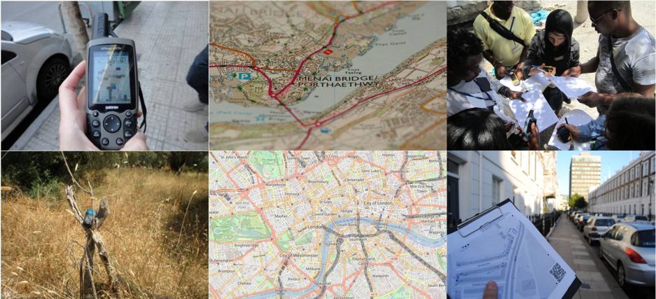
1. Aerial and Satellite Imagery (Bing Maps)
2. Field Survey data collection |
|
Process |
1. Training of a core group of people2. Field data collection3. Map a part of the city
4. Create the circumstances the project to continue by setting up an OSM community |
|
Feedback |
Topographic maps of the City |
|
Goal |
1. Map a part of the city2. Create an OSM community and train locals to continue the mapping effort.
3. Support the vision to transform Ulaanbaatar into a “Smart City”. |
|
Side effects |
– |
|
Contact Point |
– |
In the beginning of March 2013, the local authorities of Ulaanbaatar in Mongolia announced their vision to turn their city to a “Smart City” by 2020. According to the plan the aim is to enable city residents to get access to information regarding public services, to provide a consolidated list of public service assets and to allow citizens to send comments, reports, and request to relevant officials via the Internet. This effort is expected to promote transparency and fair public service while cutting down on bureaucracy (Zoljargal 2013).
Such an effort could only be successful if it could rely on a comprehensive and detailed cartographic background of the city, which did not exist at the time. To support this effort a project to map the city was funded by ICT World Bank. The aims of this project were a part of the city to be mapped under OSM guidance and simultaneously to train a core community to continue the task of mapping the entire city. The role was assigned to Humanitarin OpenStreetMap Team (HOT) while the local actors were the Mongolian University of Science and Technology (MUST) and the city officials joined by people from the Mongolian Land Management, Geodesy, and Cartography Department during the training. Also, the Ulaanbaatar City – IT department focused on the digitization on variety of POIs from businesses to trash collection points.
The followed process (Deffner, 2013) started with basic training on tracing features from imagery and moved to the handling of GPS devices data collection. The datasets were documented by field papers and ground photos which facilitate data management before the final uploading. Also, an OSM Wiki page was created (see here ) that includes useful information and a catalog of resources. This could be used by the trainees and the newly build OSM community to find training videos translated in Mongolian, OSM data collection best practices or even local tagging rules. The latter case is a quite interesting one as a consensus on the best tagging practice had to be achieved in order to describe geographic features that normally do not exist in other areas of the world and thus there is no documentation available on the OSM wiki pages.
As Deffner (2013) describes, an important challenge in the whole effort was the fact that the city of Ulaanbaatar was undergoing a great reconstruction phase and thus the available imagery datasets might not provided up-to-date information. Additionally, due to weather conditions, the data collection process was taking place during mild days while data management and upload was taking place days later, possibly by volunteers that did not collect the data themselves. It is obvious that these two factors raise some issues regarding the data quality of the datasets produced. Another factor that might influenced the overall data quality was the fact that there was no previous OSM-related background to the contributors, such as an active OSM community or available OSM wiki pages while the contributors had little knowledge of the English language that could assist them to steepen the learning curve. On the positive side, by the end of the effort that lasted for five weeks, apart from the creation of an OSM community that (despite a possible slow start) can continue the mapping project and the awareness of the local officials on the use of VGI and Open Data, the effort has also caught the eye of the private sector that is exploring the possibilities to use OSM in Web mapping applications.
Main lessons:
- Building an OSM community from scratch might be an intensive and slow progressing effort
- Spatial datasets and mapping products that come out of such a process might suffer in quality, at least until a populous and active OSM community starts to form.
- Local tagging requirements might be missing by the overall OSM project or might be considered as outliers when it comes to normalizing the dataset into a spatial product (e.g shapefile, import into a database schema etc.).
- Both governmental officials and private sector recognise the value and the potential of VGI, crowdsourced and Open Data.
References
Deffner, R. 2013. Mongolia, mapping Ulaanbaatar. [Online] Available at:
http://hot.openstreetmap.org/projects/mongolia_mapping_ulaanbaatar [Accessed 12 April 2014]
Zoljargal, M. 2013. Ulaanbaatar to become a ‘smart city’. [Online] Available at:
http://ubpost.mongolnews.mn/?p=3238 [Accessed 12 April 2014]

One thought on “Humanitarian OSM Team mapping in Mongolia”